Neulich, an der Serverkonsole des Entwicklungsservers:
17.08.2006 12:14:52 AMgr: Agent (‚xxx‘ in ‚xxx.nsf‘) printing: Hürde bis hierher genommen.
17.08.2006 12:14:52 AMgr: Agent (‚xxx‘ in ‚xxx.nsf‘) printing: in else Schleife gelaufen
 ch
chNeulich, an der Serverkonsole des Entwicklungsservers:
17.08.2006 12:14:52 AMgr: Agent (‚xxx‘ in ‚xxx.nsf‘) printing: Hürde bis hierher genommen.
17.08.2006 12:14:52 AMgr: Agent (‚xxx‘ in ‚xxx.nsf‘) printing: in else Schleife gelaufen
Ich habe den Eindruck, dass das Thema Geotagging / Geocoding grad ziemlich in ist, entsprechend viele Tools poppen dazu überall auf. Eine kleine Auswahl:
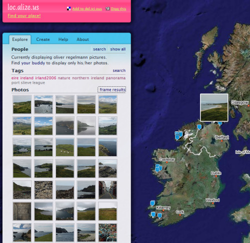
loc.alize.us zeigt mit Geotags versehene Bilder auf einer Google Map an. Man kann sich alle Bilder zu einem Ort anzeigen lassen oder nach Tags bzw. flickr-User auswählen. Feine Sache.
Ähnliches macht der KML Feed von MetalToad Media in Google Earth. Das kann man wiederzum zusammen mit dem Geotagger von flickrmap zum Setzen der entsprechenden Tags nutzen.
Hier ist noch ein flickr-Bookmarklet von Sumaato mit einer beeindruckenden Feature-Liste:
- Place Search: Find your place all around the world.
- Address Search: Street-level accuracy for US, Canada, France, Germany, Italy, Spain, Japan.
- Fast Google Map Interface: Smooth zoom, large controls, map/satellite/hybrid mode.
- Fullscreen mode: Explore our world with maximum browser space.
- Link in Description: Let others see where your pictures were taken.
- Remember location: Your last saved view will be stored for later geotagging.
- Map everyone’s photos: Run the bookmarklet on geotagged photos from your friends.
- Shortcut GeoCoder: Try searching for „nyc“ or „10101“.
- Longitude/Latatide input: Map values like „N 40°45′, W 73°59′“ or „40.75, -73.98“.
- EXIF data extraction: Auto transform of GPS injected data.
Und noch einer: webdev.yuan.cc bietet auch noch ein paar Tools zum Thema, unter anderem diverse Greasemonkey-Scripts und einen weiteren Google-Maps-Mashup für flickr.
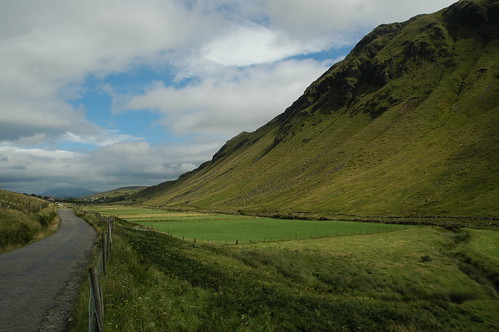
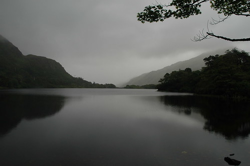
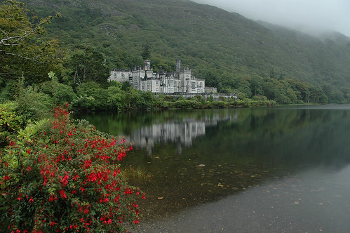
Aber den idealen Workflow rund um das Ganze habe ich noch nicht gefunden. Nach einem Trip, wie dem nach Irland kürzlich, möchte ich mit möglichst wenig Aufwand die entsprechenden GPS-Koordinaten im EXIF haben und die Bilder bei flickr automatisch mit Geotags versehen, ohne jedes einzeln anfassen zu müssen. Der erste Teil sollte mittels GPS-Tracklogs und diversen Tools kein Problem sein, aber beim zweiten hapert’s noch ein wenig. flickr selbst kann das noch nicht; das „noch“ steht hier absichtlich, offenbar ist da etwas in der Mache.
IBM:
Lotus certification announces a new certification title and role: „IBM Certified Advanced Security Professional – Notes Domino 7“. This role recognizes the more advanced level of skills required by someone in a security role and covers the following areas as they relate to security in Notes Domino 7: installation, configuration, mail, management, and maintenance.
Existing IBM Certified System Administrator – Notes and Domino 7 certificate required. Detailed exam info is yet available.
Das ist besser als die WM.
KSC 4:0, VfB 0:3. Ich kenne Leute, für die könnte die neue Saison nicht traumhafter beginnen.
Was für eine geniale Idee, Daumenkino aus Digicam-Videos:
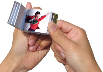
Turn your digital video clips into paper flipclips™ to carry with you, send and share!
[via Photojojo (mit Demo-Video)]
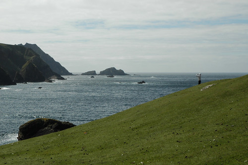
Ich flüchte vor der Hitze (Mist, gar keine Hitze mehr da) Ich bin für ein paar Tage im kühlen Norden.
You are currently browsing the regelmann.ch weblog archives for August, 2006.
ein wahrer bilderbuchstart 🙂